Perú - República del Perú La República del Perú es un país situado en la parte central y occidental de Sudamérica, frente al Océano Pacífico. Colinda con Ecuador y Colombia al norte, con los estados brasileños de Amazonas y Acre al este, con Bolivia al sureste y con Chile al sur. Su geografía le concede una gran diversidad de recursos naturales, principalmente genéticos y minerales, así como de especies y ecosistemas, por lo que es considerado un país megadiverso.
Piruw: Uralan Abya Yalapi mama llaqtam. Wichay larumanta Ikwadur llaqtawan, Kulumbiya llaqtawan tinkuna, inti lluqsiy larumantataq Brasil llaqtawan Bulibiya llaqtawan tinkuna, uray larumantataq Chili llaqtawan Bulibiya llaqtawan Titiqaqa quchawan tinkuna, inti chinkay larumantataq Pasifiku mama quchawan tinkusqa.
The Republic of Peru is a country in western South America, bordering ► Ecuador and ► Colombia to the north, ► Brazil to the east, ► Bolivia to the south-east, ► Chile to the south, and the Pacific Ocean to the west. In addition to being known as the cradle of the Inca empire, Peru is the home of many indigenous ethnic groups.
This section holds a short summary of the history of the area of present-day Peru, illustrated with maps, including historical maps of former countries and empires that included present-day Peru.
Pre-Inca cultures
Present-day Peru is settled by Quechua and Aymara between the fifth and eight century. The Wari (or in Spanish spelling and other common name, Huari Culture) was a Middle Horizon civilization that flourished in the Andes in the south of modern-day Peru, from about 500 to 1200 A.D. The capital city of the same name is located near the modern city of Ayacucho, Peru. This city was the center of a civilization that covered much of the highlands and coast of modern Peru. Early on their territory expanded to include the ancient oracle center of Pachacamac, though it seems to have remained largely autonomous. Then later it expanded to include much of the territory of the earlier Moche and later Chimu cultures.
Chimor (also Kingdom of Chimor) was the political grouping of the Chimú culture that ruled the northern coast of Peru, beginning around 850 AD and ending around 1470 AD. Chimor was the largest kingdom in the Late Intermediate period, encompassing 1000 km of coastline and including up to 2/3 of the people of the Andes. The greatest surviving ruin of this civilization is the mud city of Chan Chan.
Inca Empire
The Inca Empire was the largest empire in pre-Columbian America, and at its peak had a large empire by world standards. The administrative, political and military center of the empire was located in Cuzco. The Inca Empire arose from the highlands of Peru around 1197. From 1438 to 1533, the Incas used conquest and peaceful assimilation to incorporate a large portion of western South America, centered on the Andean mountain ranges, including large parts of modern Ecuador, Peru, Bolivia, Argentina, and Chile.See for more maps the Atlas of the Inca Empire.
Spanish rule
In 1527 the Spanish conquistador Francisco Pizarro discovers the Inca Empire. The Spanish capture the Incan capital at Cuzco by 1533 and consolidated their control by 1542. Spain founds in 1544 the Viceroyalty of Peru, including also large parts of South America. This map shows the Viceroyalty of Peru in its maximum and minimum de iure extention.
Peru's independence movement led by Jose de San Martin proclaims Peruvian independence from Spain in 1821 as a federal state existing out of Peru and Upper Peru. Since 1822 the country is named Peruvian Republic. Spain is defeated in 1824. In 1825 Upper Peru secedes as Bolivia.
In 1836 the president of Bolivia launched a project to confederate Peru and Bolivia under his "Protectorship." Both the South-Peruvian State and the North-Peruvian State are proclaimed, in each case de Santa Cruz is state's "Supreme Protector" with full powers. The Peru-Bolivian Confederation is proclaimed 1836. The confederation lasts until 1839.
Peru-Bolivian Confederation
Republic of North Peru
Republic of South Peru
Chile's victory over Peru and Bolivia in the War of the Pacific (1879-83) result in a territorial settlement. Between 1881 and 1883 Peru is occupied and it has to secede the province of Tarapacá to Chile.
This map shows the border changes as a consequence of the war.
Following the Ecuadorian-Peruvian War of 1941, the Rio Protocol sought to formalize the boundary between those two countries. This map shows the remaining territory disputed.
Old maps
This section holds copies of original general maps more than 70 years old.
The WIKIMEDIA COMMONS Atlas of the World is an organized and commented collection of geographical, political and historical maps available at Wikimedia Commons. The main page is therefore the portal to maps and cartography on Wikimedia. That page contains links to entries by country, continent and by topic as well as general notes and references.
Every entry has an introduction section in English. If other languages are native and/or official in an entity, introductions in other languages are added in separate sections. The text of the introduction(s) is based on the content of the Wikipedia encyclopedia. For sources of the introduction see therefore the Wikipedia entries linked to. The same goes for the texts in the history sections.
Historical maps are included in the continent, country and dependency entries.
The status of various entities is disputed. See the content for the entities concerned.
The maps of former countries that are more or less continued by a present-day country or had a territory included in only one or two countries are included in the atlas of the present-day country. For example the Ottoman Empire can be found in the Atlas of Turkey.


.svg)
 Amazonas
 Ancash
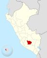 Apurímac
 Arequipa
 Ayacucho
 Cajamarca
 Callao
 Cuzco
Cuzco Huancavelica
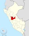 Huánuco
 Ica
Ica Junín
Junín La Libertad
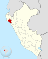 Lambayeque
 Lima
Lima Loreto
 Madre de Dios
 Moquegua
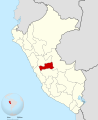 Pasco
Pasco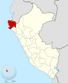 Piura
Piura Puno
Puno San Martín
 Tacna
Tacna Tumbes
 Ucayali
.svg)
.svg)
.svg)
.svg)
.svg)
.svg)
.svg)
.svg)
.svg)
.svg)
.svg)
.svg)
.svg)
.svg)
.svg)
.svg)
.svg)
.svg)
.svg)
.svg)
.svg)
.svg)
.svg)
.svg)
.svg)
 Amazonas
 Ancash
 Apurímac
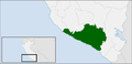 Arequipa
 Ayacucho
 Cajamarca
 Cusco
Cusco Huancavelica
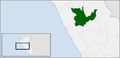 Huánuco
 Ica
Ica Junín
Junín La Libertad
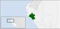 Lambayeque
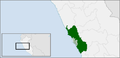 Lima
Lima Loreto
 Madre de Dios
 Moquegua
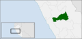 Pasco
Pasco Piura
Piura Puno
Puno San Martín
 Tacna
Tacna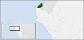 Tumbes
 Ucayali


.svg)


